***NEWS FLASH!***
Texas is big. I know, you’ve heard that somewhere before. But here’s the deal: To understand the scale of today’s post, you have to understand the scale of Texas. Driving from Texarkana, in the northeast to El Paso, in the west, takes 11-1/2 hours and covers a distance of 814 miles. A trip from Texline, near the northwest corner of the panhandle to Brownsville, at the southern tip of Texas is a 13 hour drive, spanning about 900 miles.

Here’s a map of the trip I took last weekend:
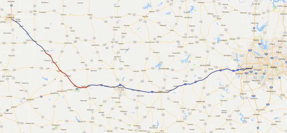 The city, at the left terminus of the route, is Lubbock, Texas. The large metropolitan area on the far right side is the Dallas / Fort Worth metroplex (DFW). The time it takes to drive from DFW to Lubbock is approximately five hours and is a journey of 335 miles (each way). My wife and I drove, from DFW to Lubbock and back again, this past weekend, to take our daughter Zoe, to college.
Notice the red curve, on each of the above maps? That is the subject of today’s post. The red curve is the drive from Justiceburg at the north end of the red road to Sweetwater at the south end. It’s about an hour’s drive, running 67 miles, give or take.
That area of North Texas is primarily farm land and rocky, dry wilderness that looks like this:
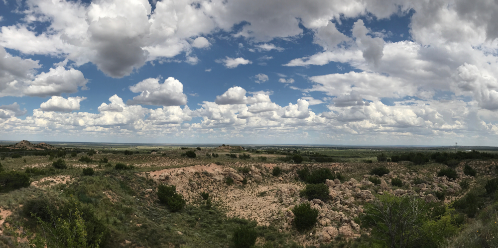
It is interesting, if somewhat monotonous scenery. Something I enjoy doing, on road trips through Texas, is to stop and read historical markers. Normally, Bonnie (my wife) hates this, but this time she obliged my “hobby.”
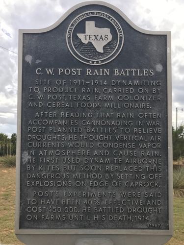 Generally, Texans are fascinated by their state’s varied history: The Alamo, the battle of San Jacinto, Bonnie & Clyde, NASA, Judge Roy Bean, Spindletop and more. Now that Bonnie (my wife, not the Bonnie of bank robbing fame) and I are empty-nesters, we can take a more leisurely approach to road trips. The first stop for us was just north of Post, Texas. The town was named after C.W. Post, of whom, you may have heard (see historical marker, to the left). Yes, the maker of Post Toasties liked to explode dynamite from kites to try to produce rain with the goal of ending droughts!
Texas history has had lots of colorful characters.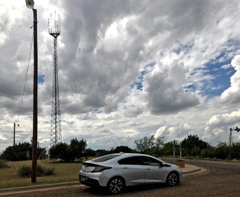
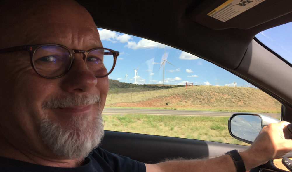
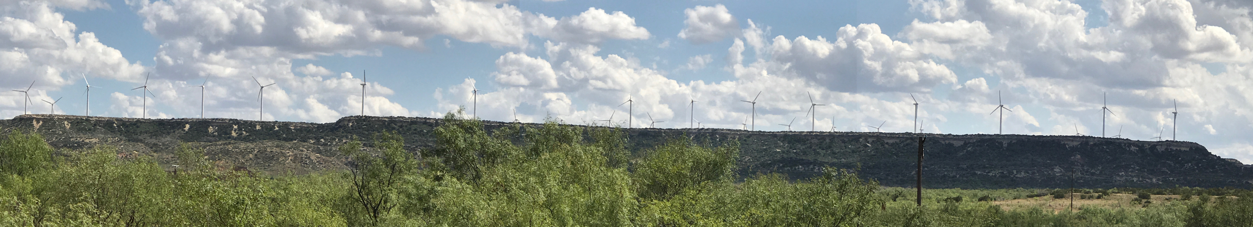
Shortly after resuming our drive, we spotted something amazing on the horizon: a wind farm. Actually, it was the northern tip of a gigantic wind farm. It wasn’t my first sight of one though. Back in February 2013, I stopped to check out a wind farm, in Indiana, while on my way to the Chicago Auto Show. I thought it was an amazing sight, with over 55 wind turbines!
This time was different.
The northern edge of this wind farm was perched, on the edge of an escarpment. This is a desirable location, due to the wind swooping up, over the escarpment, which concentrates the wind energy. The area we were driving through had lots of these long, steep cliffs, making it a good area to harvest wind energy. It also had been a good area in which to drill for oil and gas. 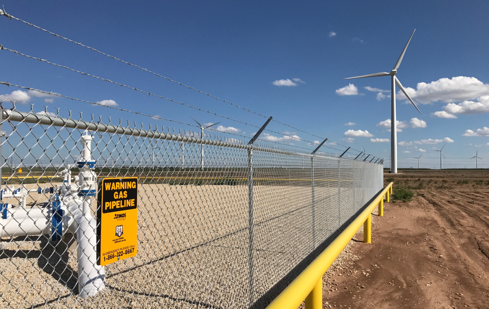 We saw many, many jack pumps, rocking slowly, up and down. What was different this time, compared to the wind farm I saw in 2013, was its size and the number of wind turbines. We saw wind turbines constantly, for at least 60 miles. They numbered in the thousands! The stretch of highway, marked in red in the maps above, show how far we traveled with wind turbines within sight. No photograph could do justice to the vista that stretched out before us. We were in awe!
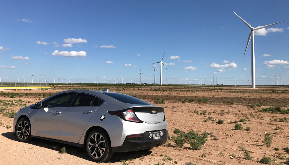
In the photo above, at much higher resolution, I was able to count 75 wind turbines. I got curious about the extent of this collection of this wind farm, so I looked at satellite imagery, once I got home.
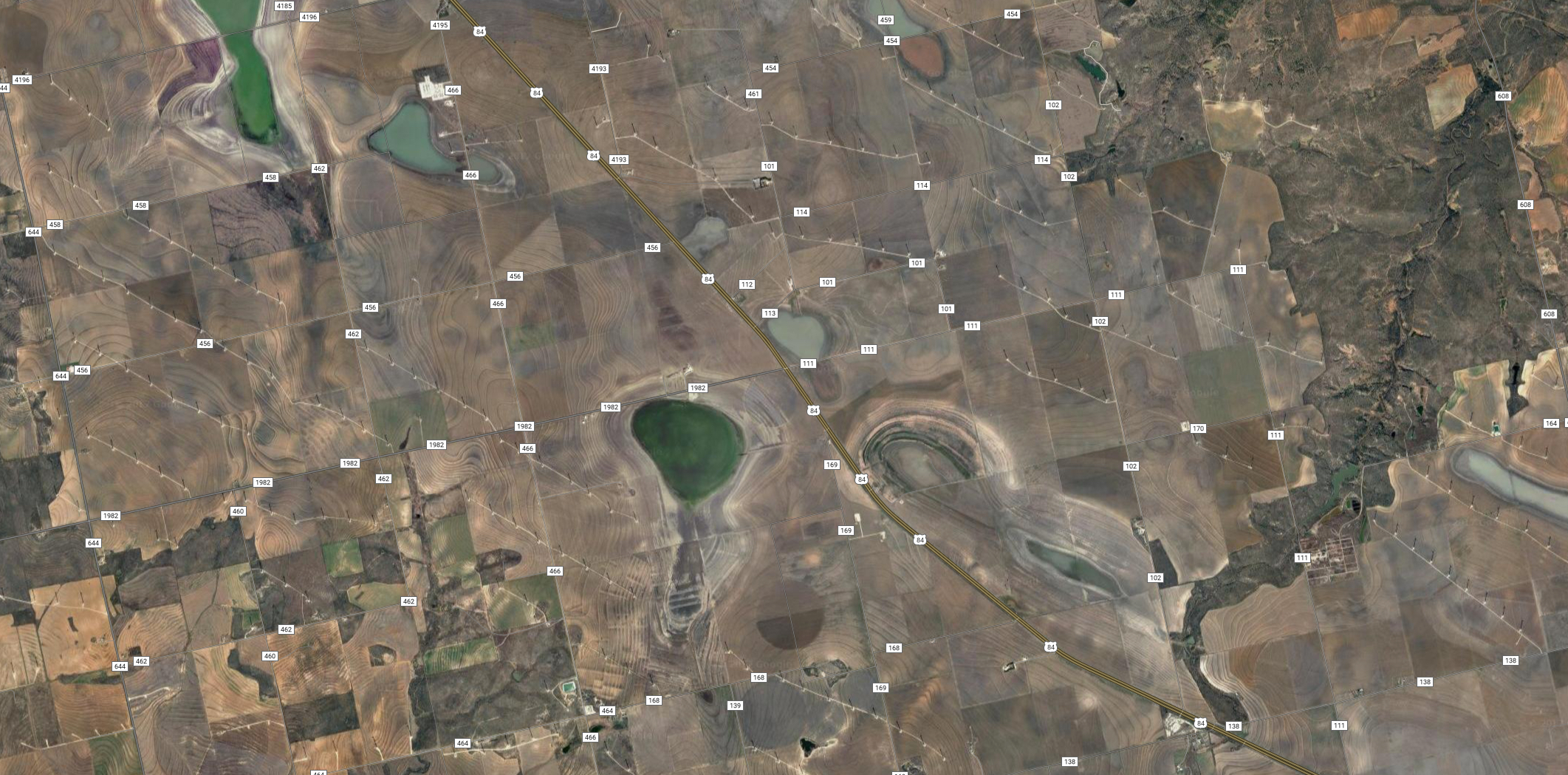
In the image above, you can easily spot the wind turbines, due to the shadows they cast. Much of the land around the turbines is farmland. For each turbine, there is a small gravel drive and pad, surrounding it. Beyond that, farmers are growing crops. This has to be a financial boon to the farmers with no negatives, like possible crop contamination. Here’s a closer view: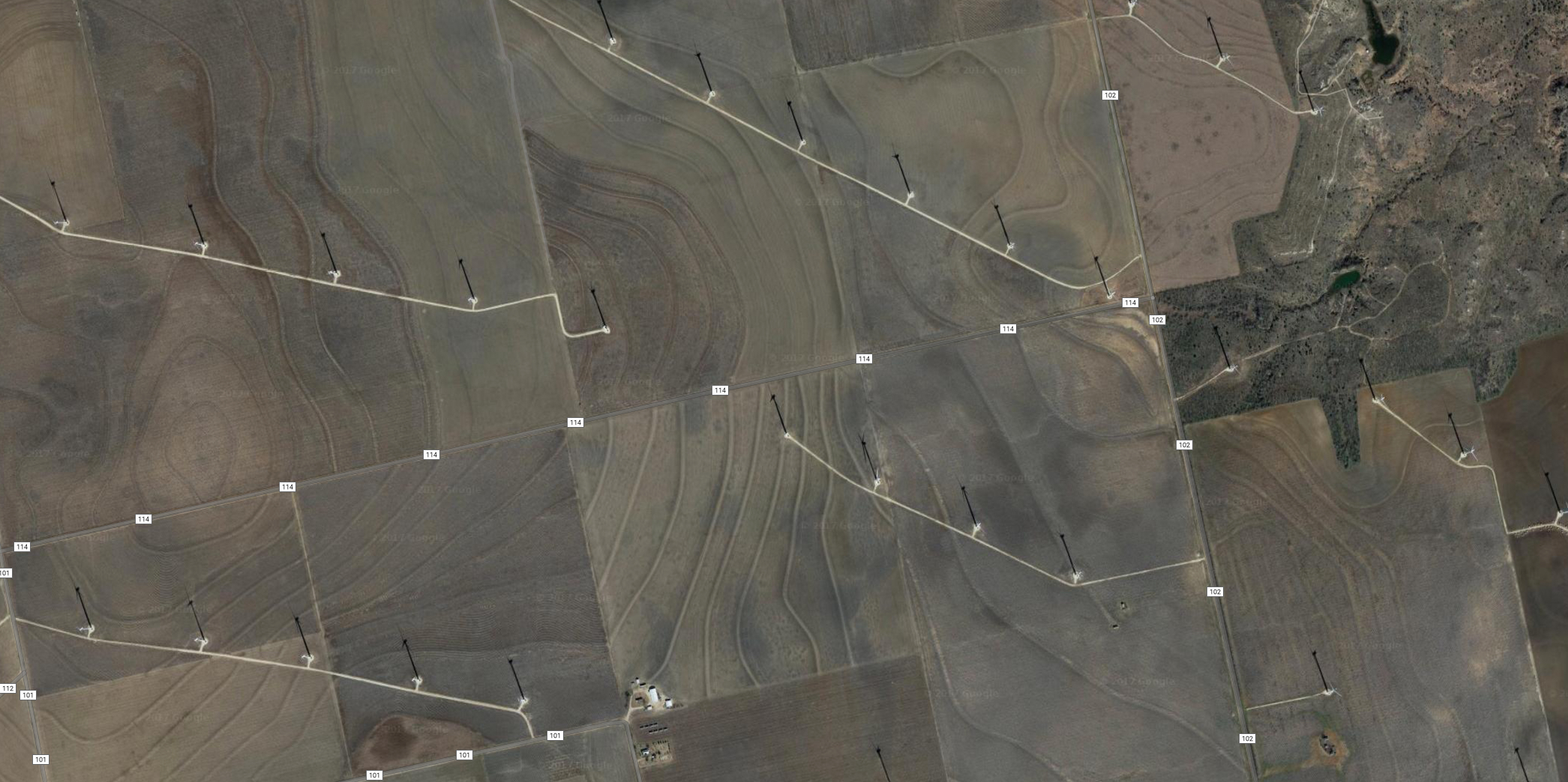
In satellite imagery, of this area of Texas, one can observe both the wind turbines as well as jack pump sites. Many Texans seem to like the image of the old, oil and gas jack pump, but I have to admit loving the beauty, grace and spectacle of the gigantic wind turbines.
Times change.
Happy to see the usa is using clean air energy and not the gas, oil wells and coal tunnels that are not only unhealthy, but the workers get contaminated working around this.
Texas may be known for oil, but we’re the #1 producer of wind energy in the U.S. Twice as much electricity is generated from wind in Texas, compared to California!